
Anaya, J. A., Montero, D., Tripathy, P., Schroeder, W., Hantson, S., Bastarrika, A., & Mahecha, M. D. (2026). Assessing fire-exposed vegetation in the Orinoco Basin using Sentinel-2 and deep learning. Sustainable Geosciences: People, Planet and Prosperity, 2, 100031. https://doi.org/10.1016/j.susgeo.2026.100031
Publications
Selected research across Earth observation, Earth system data cubes, vegetation dynamics, artificial intelligence, and open scientific software. The complete record is available on Google Scholar.
No publications match your search.
2026
Montero, D., Aybar, C., Mahecha, M. D., & Gómez-Chova, L. (2026). Towards an open registry of Earth observation instruments. The International Archives of the Photogrammetry, Remote Sensing and Spatial Information Sciences, L-4/W1-2026, 167–174. https://doi.org/10.5194/isprs-archives-l-4-w1-2026-167-2026
Camps-Valls, G., Carrassi, A., de Melo Viríssimo, F., Debeire, K., Fernández-Torres, M.-Á., Hess, P., Heuer, H., Mankovich, N., Montero, D., Rodrigo-Bonet, E., Serva, F., Sitokonstantinou, V., White, A., Cohrs, K.-H., Wider, J., Reimers, C., Bountos, N. I., Papoutsis, I., Gentine, P., & Eyring, V. (2026). Bridging the weather and climate divide with artificial intelligence. Nature Communications, 17(1). https://doi.org/10.1038/s41467-026-75787-y
Peters, J., Mora, K., Mahecha, M. D., Ji, C., Montero, D., Mosig, C., & Kraemer, G. (2026). Context-Aware Multimodal Representation Learning for Spatio-Temporally Explicit Environmental Modeling. IEEE Transactions on Geoscience and Remote Sensing, 64, 4412311–4412311. https://doi.org/10.1109/tgrs.2026.3707966
Mahecha, M. D., Kraemer, G., Reinhardt, M., Montero, D., Gans, F., Bastos, A., Feilhauer, H., Flik, I., Ji, C., Kattenborn, T., Migliavacca, M., Mönks, M., Quaas, J., Sippel, S., Walther, S., Wieneke, S., Wirth, C., & Camps-Valls, G. (2026). Accelerated north-east shift of the global green wave trajectory. Proceedings of the National Academy of Sciences, 123(9). https://doi.org/10.1073/pnas.2515835123
Williams, T. K. E., Durand, H., Braun, T., Martinuzzi, F., Montero, D., Mahecha, M. D., & Camps-Valls, G. (2026). Kernel detrended fluctuation analysis: A nonlinear, multivariate method for detecting long-range persistence. Chaos: An Interdisciplinary Journal of Nonlinear Science, 36(3). https://doi.org/10.1063/5.0316179
Mosig, C., Kattenborn, T., Montero Loaiza, D., Vanja-Jehle, J., Brandt, J., Jacobs, N., Khanal, S., Xing, E., Schwartz, M., Muller-Landau, H. C., Beloiu, M., Bozzini, A., Cheng, Y., Ganz, K., Grüning, B., Hartmann, H., Hempel, J., Horion, S., Junttila, S., … Mahecha, M. (2026). Sub-pixel mapping of disturbance and tree mortality dynamics from Sentinel-2 time series around the globe. California Digital Library (CDL). https://doi.org/10.31223/x5b18w
Muñoz, E., Anaya, J. A., Clerici, N., Estupinan-Suarez, L. M., Lopera, I., Richter, S., Salazar, A., Sierra, C. A., Tangarife-Escobar, A., Mahecha, M. D., Montero, D., Palacios-Rodríguez, P., Ramos, P., & Botía, S. (2026). An interdisciplinary review of the interplay of conflict, socio-economic factors, and land cover and vegetation dynamics in Colombia. PLANTS, PEOPLE, PLANET. https://doi.org/10.1002/ppp3.70157
Mosig, C., Vajna-Jehle, J., Mahecha, M. D., Cheng, Y., Hartmann, H., Montero, D., Junttila, S., Horion, S., Schwenke, M. B., Koontz, M. J., Maulud, K. N. A., Adu-Bredu, S., Al-Halbouni, D., Ali, M., Allen, M., Altman, J., Amorós, L., Angiolini, C., Astrup, R., … Kattenborn, T. (2026). deadtrees.earth — An open-access and interactive database for centimeter-scale aerial imagery to uncover global tree mortality dynamics. Remote Sensing of Environment, 332, 115027. https://doi.org/10.1016/j.rse.2025.115027
2025
Montero, D., Mahecha, M. D., Martinuzzi, F., Aybar, C., Klosterhalfen, A., Knohl, A., Anaya, J., Mosig, C., & Wieneke, S. (2025). Transformers vs. Recurrent Models for Estimating Forest Gross Primary Production. arXiv. https://doi.org/10.48550/ARXIV.2511.11880
Galaz, V., Schewenius, M., Donges, J. F., Fetzer, I., Zhivkoplias, E., Barfuss, W., Delannoy, L., Wang-Erlandsson, L., Gelbrecht, M., Heitzig, J., Hentati-Sundberg, J., Kennedy, C., Knecht, N., Lotcheris, R., Mahecha, M., Merrie, A., Montero, D., McPhearson, T., Mustafa, A., … Vadrot, A. (2025). AI for a Planet Under Pressure. arXiv. https://doi.org/10.48550/ARXIV.2510.24373
Lou, C., Stoy, P. C., Franco, J. G., Montero, D., & Zhang, Z. (2025). Symbolic regression for discovering vegetation indices: a case study using alfalfa biomass estimation. Wiley. https://doi.org/10.22541/essoar.175760488.82763731/v1
Söchting, M., Scheuermann, G., Montero, D., & Mahecha, M. D. (2025). Interactive Earth system data cube visualization in Jupyter notebooks. Big Earth Data, 9(2), 321–335. https://doi.org/10.1080/20964471.2025.2471646
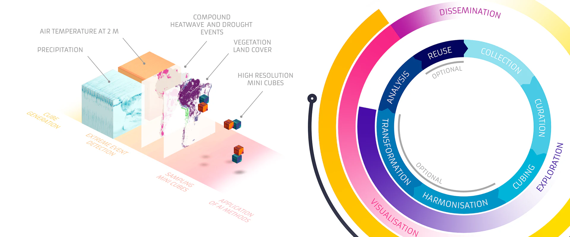
Ji, C., Fincke, T., Benson, V., Camps-Valls, G., Fernández-Torres, M.-Á., Gans, F., Kraemer, G., Martinuzzi, F., Montero, D., Mora, K., Pellicer-Valero, O. J., Robin, C., Söchting, M., Weynants, M., & Mahecha, M. D. (2025). DeepExtremeCubes: Earth system spatio-temporal data for assessing compound heatwave and drought impacts. Scientific Data, 12(1). https://doi.org/10.1038/s41597-025-04447-5
Aybar, C., Contreras, J., Ma, C., Pellicer-Valero, O. J., Mateo-García, G., Gómez-Chova, L., Camps-Valls, G., Lehmann, N., Czerkawski, M., Montero, D., Mahecha, M. D., & Aybar, I. (2025). The Missing Piece: Standardising for AI-ready Earth Observation Datasets. In TerraBytes - ICML 2025 workshop. https://openreview.net/forum?id=HV6F0dsGLK
2024
Aybar, C., Montero, D., Contreras, J., Donike, S., Kalaitzis, F., & Gómez-Chova, L. (2024). SEN2NAIP: A large-scale dataset for Sentinel-2 Image Super-Resolution. Scientific Data, 11(1). https://doi.org/10.1038/s41597-024-04214-y
Martinuzzi, F., Mahecha, M. D., Camps-Valls, G., Montero, D., Williams, T., & Mora, K. (2024). Learning extreme vegetation response to climate drivers with recurrent neural networks. Nonlinear Processes in Geophysics, 31(4), 535–557. https://doi.org/10.5194/npg-31-535-2024
Kattenborn, T., Wieneke, S., Montero, D., Mahecha, M. D., Richter, R., Guimarães-Steinicke, C., Wirth, C., Ferlian, O., Feilhauer, H., Sachsenmaier, L., Eisenhauer, N., & Dechant, B. (2024). Temporal dynamics in vertical leaf angles can confound vegetation indices widely used in Earth observations. Communications Earth & Environment, 5(1). https://doi.org/10.1038/s43247-024-01712-0
Aybar, C., Bautista, L., Montero, D., Contreras, J., Ayala, D., Prudencio, F., Loja, J., Ysuhuaylas, L., Herrera, F., Gonzales, K., Valladares, J., Flores, L. A., Mamani, E., Quiñonez, M., Fajardo, R., Espinoza, W., Limas, A., Yali, R., Alcántara, A., … Gómez-Chova, L. (2024). CloudSEN12+: The largest dataset of expert-labeled pixels for cloud and cloud shadow detection in Sentinel-2. Data in Brief, 56, 110852. https://doi.org/10.1016/j.dib.2024.110852
Montero, D., Mahecha, M. D., Martinuzzi, F., Aybar, C., Klosterhalfen, A., Knohl, A., Koebsch, F., Anaya, J., & Wieneke, S. (2024). Recurrent Neural Networks for Modelling Gross Primary Production. In IGARSS 2024 - 2024 IEEE International Geoscience and Remote Sensing Symposium (pp. 4214–4217). IEEE. https://doi.org/10.1109/igarss53475.2024.10640715
Montero, D., Aybar, C., Ji, C., Kraemer, G., Söchting, M., Teber, K., & Mahecha, M. D. (2024). On-Demand Earth System Data Cubes. In IGARSS 2024 - 2024 IEEE International Geoscience and Remote Sensing Symposium (pp. 7529–7532). IEEE. https://doi.org/10.1109/igarss53475.2024.10640742
Martinuzzi, F., Mahecha, M. D., Montero, D., Alonso, L., & Mora, K. (2024). SpectralIndices.jl: Streamlining spectral indices access and computation for Earth system research. The International Archives of the Photogrammetry, Remote Sensing and Spatial Information Sciences, XLVIII-4/W12-2024, 89–95. https://doi.org/10.5194/isprs-archives-xlviii-4-w12-2024-89-2024
Aybar, C., Montero, D., Donike, S., Kalaitzis, F., & Gómez-Chova, L. (2024). A Comprehensive Benchmark for Optical Remote Sensing Image Super-Resolution. IEEE Geoscience and Remote Sensing Letters, 21, 1–5. https://doi.org/10.1109/lgrs.2024.3401394
Montero, D., Mahecha, M. D., Aybar, C., Mosig, C., & Wieneke, S. (2024). Facilitating advanced Sentinel-2 analysis through a simplified computation of Nadir BRDF Adjusted Reflectance. The International Archives of the Photogrammetry, Remote Sensing and Spatial Information Sciences, XLVIII-4/W12-2024, 105–112. https://doi.org/10.5194/isprs-archives-xlviii-4-w12-2024-105-2024
Montero, D., Kraemer, G., Anghelea, A., Aybar, C., Brandt, G., Camps-Valls, G., Cremer, F., Flik, I., Gans, F., Habershon, S., Ji, C., Kattenborn, T., Martínez-Ferrer, L., Martinuzzi, F., Reinhardt, M., Söchting, M., Teber, K., & Mahecha, M. D. (2024). Earth System Data Cubes: Avenues for advancing Earth system research. Environmental Data Science, 3. https://doi.org/10.1017/eds.2024.22
Söchting, M., Mahecha, M. D., Montero, D., & Scheuermann, G. (2024). Lexcube: Interactive Visualization of Large Earth System Data Cubes. IEEE Computer Graphics and Applications, 44(1), 25–37. https://doi.org/10.1109/mcg.2023.3321989
2023
Aybar, C., Montero, D., Barja, A., Herrera, F., Gonzales, A., & Espinoza, W. (2023). Combining R and Earth Engine. In Cloud-Based Remote Sensing with Google Earth Engine (pp. 629–651). Springer International Publishing. https://doi.org/10.1007/978-3-031-26588-4_31
Aybar, C., Montero, D., Mateo-García, G., & Gómez-Chova, L. (2023). Lessons Learned From Cloudsen12 Dataset: Identifying Incorrect Annotations in Cloud Semantic Segmentation Datasets. In IGARSS 2023 - 2023 IEEE International Geoscience and Remote Sensing Symposium (pp. 892–895). IEEE. https://doi.org/10.1109/igarss52108.2023.10282381
Montero, D., Aybar, C., Mahecha, M. D., Martinuzzi, F., Söchting, M., & Wieneke, S. (2023). A standardized catalogue of spectral indices to advance the use of remote sensing in Earth system research. Scientific Data, 10(1). https://doi.org/10.1038/s41597-023-02096-0
2022
Aybar, C., Ysuhuaylas, L., Loja, J., Gonzales, K., Herrera, F., Bautista, L., Yali, R., Flores, A., Diaz, L., Cuenca, N., Espinoza, W., Prudencio, F., Llactayo, V., Montero, D., Sudmanns, M., Tiede, D., Mateo-García, G., & Gómez-Chova, L. (2022). CloudSEN12, a global dataset for semantic understanding of cloud and cloud shadow in Sentinel-2. Scientific Data, 9(1). https://doi.org/10.1038/s41597-022-01878-2
Montero, D., Aybar, C., Mahecha, M. D., & Wieneke, S. (2022). SPECTRAL: AWESOME SPECTRAL INDICES DEPLOYED VIA THE GOOGLE EARTH ENGINE JAVASCRIPT API. The International Archives of the Photogrammetry, Remote Sensing and Spatial Information Sciences, XLVIII-4/W1-2022, 301–306. https://doi.org/10.5194/isprs-archives-xlviii-4-w1-2022-301-2022
2021
Montero, D. (2021). eemont: A Python package that extends Google Earth Engine. Journal of Open Source Software, 6(62), 3168. https://doi.org/10.21105/joss.03168
2018
Montero, D., Echeverry, F., & Hernández, F. (2018). Combination of satellite imagery with meteorological data for estimating reference evapotranspiration. Revista de Teledetección, (51), 75. https://doi.org/10.4995/raet.2018.7688
2017
Valencia, J. M., García, C. E., & Montero, D. (2017). Anomalías de vegetación asociadas con el fenómeno del ENOS en el valle geográfico del río Cauca, Colombia. Revista de Teledetección, (50), 89. https://doi.org/10.4995/raet.2017.7715
García, C. E., Montero, D., & Chica, H. A. (2017). Evaluation of a NIR camera for monitoring yield and nitrogen effect in sugarcane. Agronomía Colombiana, 35(1), 82–91. https://doi.org/10.15446/agron.colomb.v35n1.60852